
Breaking barriers in geospatial: Amazon Redshift, CARTO, and H3
AWS Big Data
MAY 16, 2024
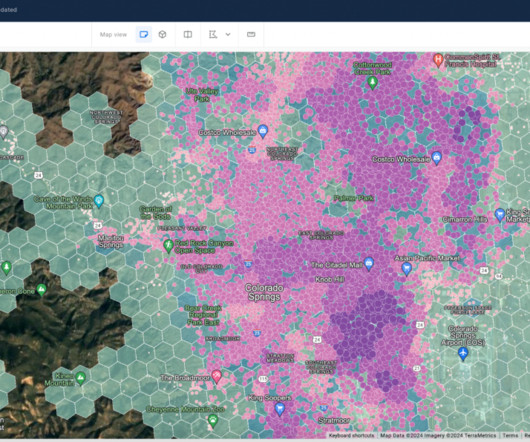
However, visualizing and analyzing large-scale geospatial data presents a formidable challenge due to the sheer volume and intricacy of information. This often overwhelms traditional visualization tools and methods. Figure 1 – Map built with CARTO Builder and the native support to visualize H3 indexes What are spatial indexes?


Let's personalize your content